Drone Photo Editing Services
Different platforms require different image specifications. Our cropping and resizing service ensures your property photos meet MLS standards, social media dimensions, print specifications, and web optimization requirements — all while maintaining maximum image quality.
About Our Drone Photo Editing
At Pixel Picture Solutions, our drone photo editing team specializes in the unique challenges of aerial imagery. Unlike standard ground-level photography, drone photos require specialized corrections — wide-angle lens barrel distortion, atmospheric haze removal, dynamic range balancing between bright skies and shadowed ground, and precise color grading that makes landscapes, properties, and developments look their very best.
We work with all major drone platforms including DJI Phantom, DJI Mavic, DJI Air series, Autel EVO, Skydio, and Parrot drones. Our editors are experienced in processing RAW files from every popular UAV camera sensor, ensuring maximum detail retention in every edit.
Whether you are a real estate photographer, construction surveyor, event aerial videographer, or commercial drone operator, we deliver consistent, professional results with a fast 8–12 hour turnaround — so your clients never have to wait.
Comprehensive Drone Image Post-Processing
Our drone image editing workflow covers every correction and enhancement your aerial photos need to reach their full potential. From technical fixes to creative enhancements, we handle the complete post-processing pipeline so you can focus on flying.
What's Included in Every Edit
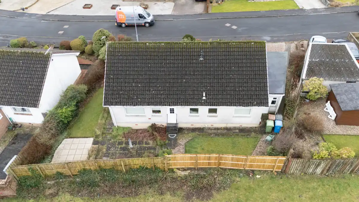
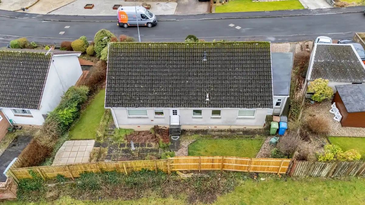
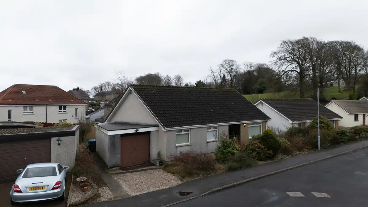
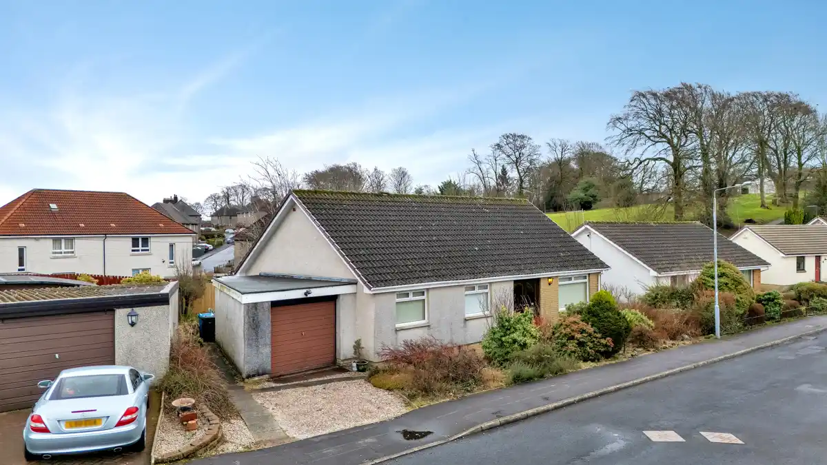
Drone Photo Editing Example
Drag to Compare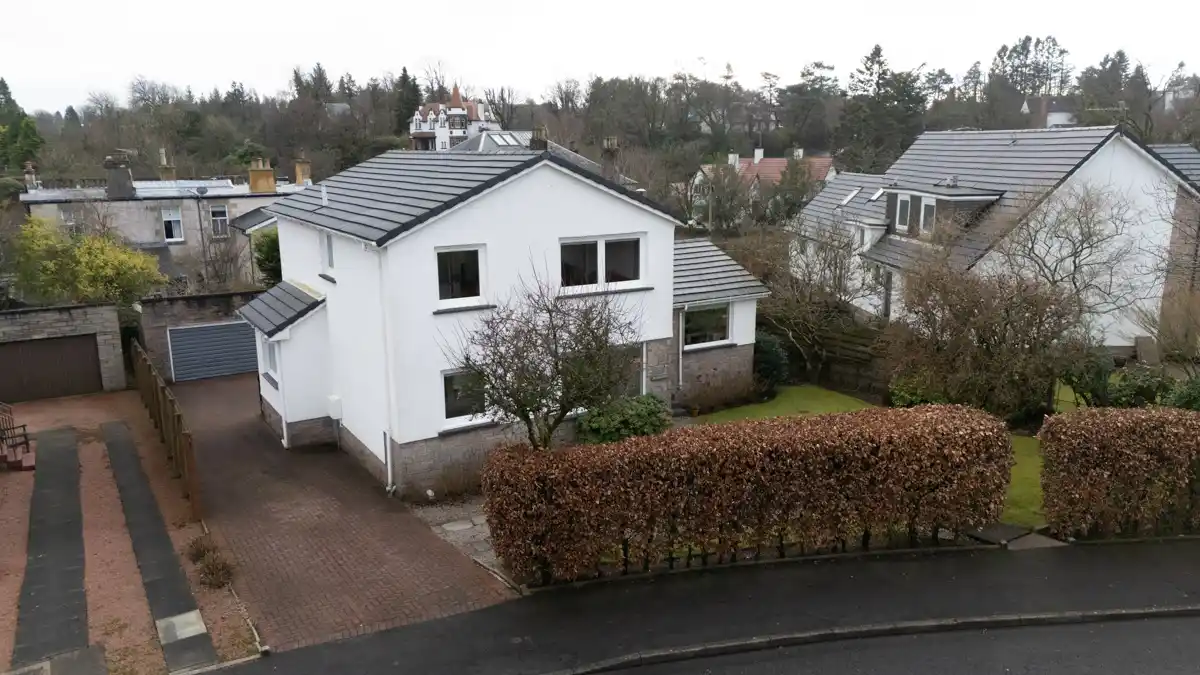
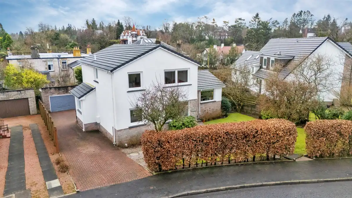 BeforeAfter
Drone Aerial Photo — Color Grading & Sky Enhancement
Raw aerial capture transformed with professional color grading, sky replacement, and haze removal for a dramatic, publication-ready result.
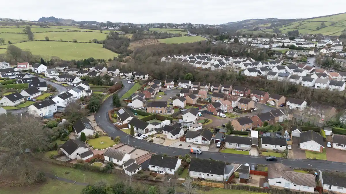
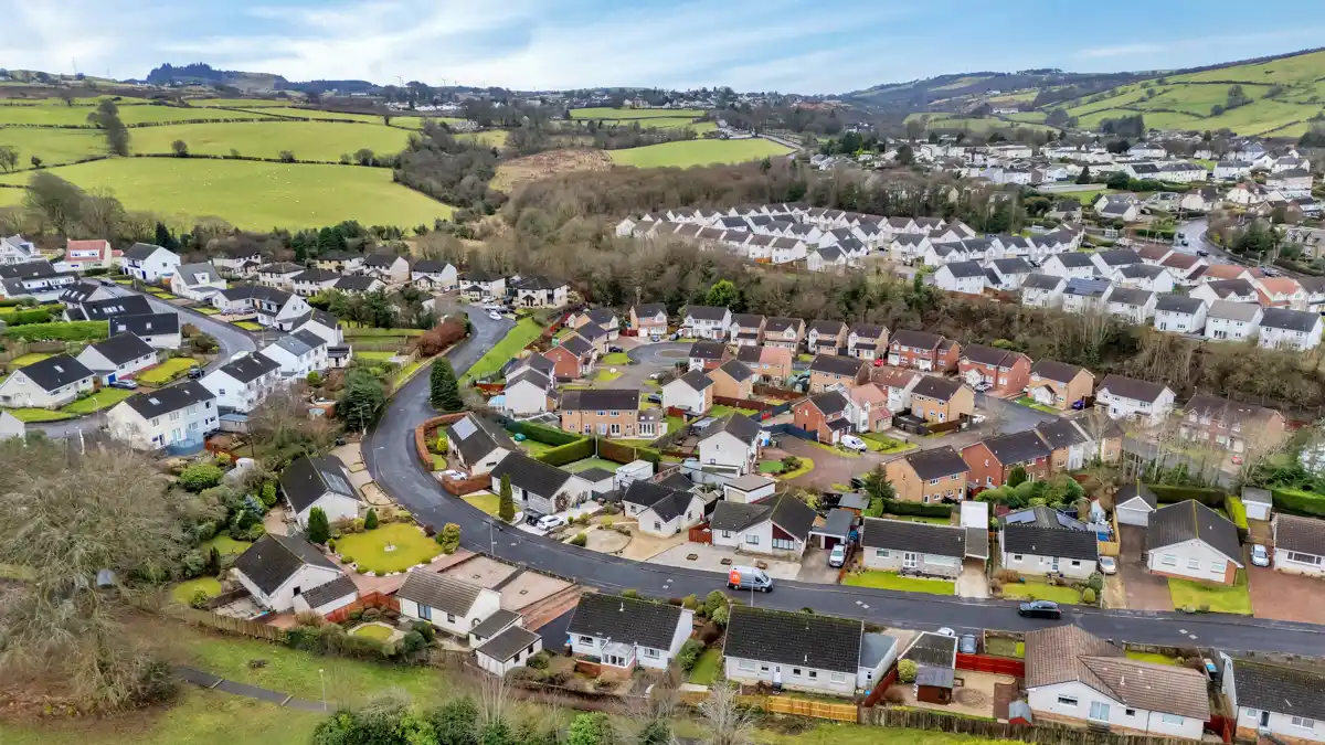
Drone Photo Editing for Real Estate Aerial Photography
Aerial drone photography is one of the most powerful tools in modern real estate marketing. Properties photographed from above show the full lot size, neighborhood context, proximity to amenities, and architectural layout in a way no ground-level shot can match. However, raw drone images often suffer from flat colors, overexposed skies, distracting power lines, and the visible fisheye effect of wide-angle drone lenses. Our real estate drone photo editing service corrects all of these issues while adding the warm, inviting color palette that makes listings stand out on MLS, Zillow, and Realtor.com. We routinely edit aerial exteriors, bird's-eye property overviews, neighborhood context shots, and drone-captured day-to-dusk conversions for real estate photographers across the United States, Canada, Australia, and the United Kingdom.
Specialized Drone Editing Capabilities
Beyond standard color correction, our team offers advanced drone photo editing techniques that elevate your aerial images to a truly professional level. Our drone day-to-twilight conversion transforms flat midday aerial shots into golden-hour masterpieces complete with glowing windows, warm sky gradients, and vibrant landscaping. Object removal eliminates distracting elements such as cars in driveways, garbage bins, construction equipment, utility wires, and shadows cast by the drone itself. For commercial and construction clients, we provide orthophoto enhancement, progress documentation editing, and consistent color matching across multi-date site survey image sets.
Why Choose PPS for Drone Photo Editing?
Our team combines deep Lightroom and Photoshop expertise with a thorough understanding of how aerial images are used in real estate marketing, construction documentation, and commercial content. Every drone photo we edit is handled by a dedicated human editor — never automated filters — ensuring precise, consistent results that match your brand style.
Contact us at info@pixelpicturesolutions.com to get started.